The Global Positioning System
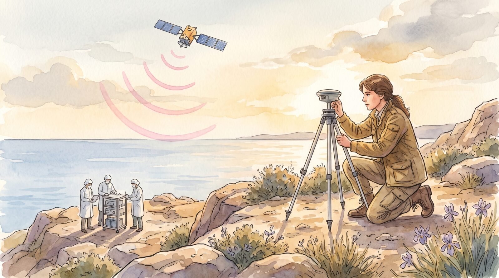
Why GPS Is Harder Than People Realise
Most introductions to the Global Positioning System say that it works by trilateration: a receiver on Earth takes the signals from a constellation of satellites, multiplies the travel time by the speed of light, and solves for its own position in three dimensions. This is correct so far as it goes. What it does not capture is that the entire system depends on one fact: every satellite and every receiver must agree on the time. Not approximately, and not to within a millisecond. To within tens of nanoseconds. The period of the satellite’s clock and the period of the receiver’s clock must be measured against the same standard, and the difference must be transmitted in the radio signal. The whole question of where you are reduces, in the end, to the question of when you are.
This is why the GPS story begins not in the Air Force or the Pentagon but in the timekeeping division of a US naval laboratory in 1964. By the early 1960s, three problems were colliding. The Navy wanted a way to give its missile submarines, surface ships, and aircraft a continuous position fix in any weather. The Air Force wanted to be able to drop smart munitions accurately without ground radar. Civilian aviators and mariners wanted a single global system to replace the proliferation of regional radio beacons. The trick was that no available location method could meet all these needs at once, because the precision they required was geometrically impossible with the clocks of the day.
A ground-based radio navigation fix had been possible since the Second World War, when the LORAN system came online. LORAN measured time differences between pairs of stable ground transmitters. But LORAN could not be used by a fast-moving aircraft over the ocean, and it required very long baseline stations; it covered about one per cent of the Earth’s surface at any given moment. The Navy’s earlier satellite-based system, Transit, could provide a position fix anywhere on Earth roughly once an hour with rather poor accuracy, but it could not be used in real time by moving platforms. The Air Force’s 621B program studied satellite-based signals from a different angle. None of them individually worked.
The breakthrough was to recognise that the same atomic clock technology used inside each satellite could serve as the time reference for all satellites at once. Once each satellite had an accurate clock of its own, and broadcast that clock’s reading in its signal, a receiver that knew the satellites’ locations would only have to compare its own clock reading against the readings it was receiving to compute the position fix. The catch was that the satellites had to have extremely accurate clocks, and they had to know where they were; that the receiver’s own clock had to be cheap, because most users wouldn’t have an atomic clock; and that the geometry of the constellation had to be such that four satellites were always above the horizon for any point on Earth at any time.
That is the conceptual architecture of any modern global navigation satellite system, and it was clean enough that the three competing programs (the Navy’s Timation, the Air Force’s 621B, and the Army’s SECOR) all converged on roughly the same mathematical model in the early 1970s. In December 1973 the Department of Defense combined them under one program office, the Navstar GPS Joint Program Office, and the modern Global Positioning System was on.
This is where the timekeeping origin matters. GPS was not a navigation system that happened to use clocks. It was a clock system that happened to be useful for navigation. Every engineering choice that followed was constrained by what was feasible in the time domain.
The Hardware: Atomic Clocks and the Block I Satellites
The first engineering problem was to put a real atomic clock on a satellite. The Naval Research Laboratory had begun working on this in 1964 under the name Timation, short for “time navigation.” The first two Timation satellites, launched in 1967 and 1968, used crystal oscillators rather than atomic clocks, because no atomic clock small enough to fly reliably had yet been built in production. The third Timation, launched in 1974 under the name NTS-2, was the first satellite in orbit to carry a rubidium atomic clock. The fourth satellite, NTS-3, was launched in 1977 and demonstrated a more accurate clock design. These were research satellites and lasted only a few months in orbit, but they validated the timing argument.
Once the GPS Joint Program Office was approved, it turned to Rockwell International under a June 1974 contract. Rockwell was responsible for the satellite buses and most of the navigation payload. The first set of vehicles to be built, the Block I series, were 845-kilogram three-axis stabilised spacecraft running on solar arrays with onboard nickel-cadmium batteries, hydrazine thrusters for orbit maintenance, and S-band communications for telemetry and control. They had a design life of about four and a half years. Eleven were launched between February 1978 and October 1985; one was lost in a launch failure.
The crucial payload was the navigation subsystem. Each Block I satellite carried two rubidium atomic clocks and two cesium atomic clocks, of which only one was the active master at any time. The clocks were the size of a small suitcase; they weighed roughly thirteen kilograms each; and they had to be stable enough that they lost no more than a few nanoseconds per day, otherwise the position fix would drift. By the standards of the technology of the 1970s, this was a remarkable engineering feat. The atomic clocks were built by a small handful of suppliers, including Frequency Electronics, Efratom, and L3Harris; their work made GPS feasible.
The signal architecture was equally deliberate. Block I satellites transmitted on two frequencies simultaneously: L1 at 1575.42 MHz and L2 at 1227.60 MHz. The choice of two frequencies was important because the ionosphere delays the radio signal by a measurable amount, but the delay is different at the two frequencies; comparing the two signals allows the receiver to subtract out most of the ionospheric error. Both signals were modulated with a pseudorandom code that looks like noise, but encodes to the receiver the exact time at which the satellite’s clock said the signal left. The receiver cross-correlates the incoming signal with a copy of the code stored locally, computes the time delay, multiplies by the speed of light, and gets a range to the satellite. Do that with four satellites and you can solve for x, y, z, and the receiver’s clock offset.
That is the heart of the system. Everything else — the ground control segment, the user equipment, the orbit determination — exists to keep the satellite clocks accurate enough that the timing arithmetic remains valid.
The constellations of the late 1970s were incomplete. The first launch on 22 February 1978 was the satellite called Navstar 1, built by Rockwell. Three more Block I satellites were launched by the end of 1978, allowing the Air Force to do provisional testing of the system. By the time the rest of the Block I launches were complete in 1985, the satellites — in orbit around 20,000 kilometres up in carefully chosen circular orbits — were good enough to demonstrate the principle continuously. Most of them, as a side note, lasted much longer than their design life. The longest-lived Block I satellite, launched in 1983, remained partly operational until 2016, more than thirty years after launch.
The first decisive operational test came in the early 1980s, when American soldiers in the field began using the constellation for navigation, often in the back of a vehicle, with the ground receiver mounted on the dashboard. By the time of the US invasion of Panama in December 1989, the system was good enough to be relied on by individual infantrymen in the field. By the time of Operation Desert Storm in early 1991, the constellation was complete enough and the receivers were small enough that the US Army used it as the primary navigation system for combat units, and the global significance of GPS was sealed.
The Constellation and Its Politics
The politically interesting part of the GPS story begins around 1983. On 1 September 1983, a Korean Air Lines Boeing 747, flight 007, strayed into Soviet airspace over the Kamchatka Peninsula after a navigation error; the Soviets shot it down, killing all 269 people aboard. The disaster forced President Reagan to decide what the policy on civilian use of GPS would be: the system had been classified as military, and military systems in the Cold War were not normally shared with civilians. Reagan’s announcement on 16 September 1983 — that, once GPS became operational, the system would be made available for civilian use too — was thus a deliberate political choice rather than a technical inevitability.
Operational readiness was declared in July 1995 and the full 24-satellite constellation was completed in March 1994, but civilian use had been unblocked earlier. The first civilian receivers were large, expensive, and slow. By the late 1980s they had begun to get small enough to fit in a backpack. Through the 1990s GPS receivers fell in cost and size, and by the late 1990s several companies were selling handheld devices accurate to a few metres for a few hundred dollars.
But the civilian signal was degraded artificially. The deliberate error, called Selective Availability, introduced a small random error into the satellite signals, giving civilian users only about a hundred metres of accuracy rather than the three-to-five metres that military receivers could achieve with the unencrypted precision code. The reason for the degradation was to deny a precise fix to potential adversaries during a war; the United States could switch Selective Availability off globally if it needed to (as President Clinton did briefly in 1996 during operations in the Persian Gulf) and back on when it didn’t. The cat-and-mouse with civilian users went on for the better part of a decade, and it created an entire engineering industry in the differential GPS market, in which a fixed receiver at a known location transmitted corrections to shipboard or airborne GPS receivers. Several of these differential networks were more accurate than the unencrypted military signal in normal use.
In May 2000, in one of the more consequential policy changes of the early twenty-first century, President Bill Clinton issued an executive order discontinuing Selective Availability. From that day civilian users got the same accuracy that had previously been available only to the military. The order took effect at midnight on 1 May 2000. Within ten years location-aware devices had become a consumer industry, and within twenty they had become the substrate of most of the consumer internet. The numbers are striking: before the order, the global market for civilian GPS hardware was about a billion dollars a year; today the equivalent market is dominated by smartphone chipsets that cost a fraction of a dollar each, and the global location-based services industry is worth hundreds of billions.
The political story matters because GPS was always a public infrastructure project with military origins. The Department of Defense funded the constellation; it selected the orbits and frequencies; it has full control of the system. Even after Selective Availability was disabled, the United States can encrypt the satellite signals further (which is what the M-Code is for) and, if necessary, deny GPS over a region. The same architecture can be used by anyone with enough rockets, enough rubidium, and the determination to spend about two per cent of America’s defense budget: the Chinese BeiDou system, the Russian GLONASS system, the European Galileo system, and the Indian IRNSS / NavIC system all use the same timekeeping-based principle as GPS. Most modern receivers are designed to listen on multiple constellations simultaneously.
Politics enters GPS in another way too: the size of the constellation. The original constellation design was 24 satellites in six orbital planes. The operational constellation has drifted above 31 satellites in recent years because newer generations had to be launched as older satellites were retired. By 2024 the GPS constellation was providing global service with 31 operational satellites and several more in reserve. The replacement satellites, of which Block III has been in service since 2018, include new signal structures, more accurate clocks (specifically rubidium clocks with a stability of about ten nanoseconds per day, plus a third-generation clock designed by the Jet Propulsion Laboratory that is far more accurate again), and stronger anti-jamming capabilities.
The Relativity Gotcha
The most surprising chapter in the GPS story — and the one most often missed by writers who summarise it at the level of trilateration — is the central role of relativity in the system design. Without correction for Einstein, the system would not work.
The point is that the satellite clocks and the Earth-bound clocks, both of which are accurate to nanoseconds, run at different rates according to both special and general relativity. There are two effects, and they have to be calculated separately.
The first is the special-relativistic time dilation predicted for any moving clock. A satellite moving at 3.87 kilometres per second in its 20,200-kilometre-high orbit runs slow relative to a stationary observer by about seven microseconds per day. This is the textbook time dilation.
The second is the general-relativistic effect of being higher in the Earth’s gravitational field. A clock in orbit is further from the Earth’s mass than a clock on the ground and therefore runs faster. The number is about 45 microseconds per day, with the opposite sign to the special relativity effect.
The two effects do not cancel. The satellite clock wins, in net, by about 38 microseconds per day. That sounds tiny, but GPS works in nanoseconds, and a 38-microsecond error per day corresponds to a position error of about 11 kilometres per day. Uncorrected, the system would be useless within hours.
The fix is what makes GPS a beautiful object from a physics standpoint. Before launch, the satellite’s atomic clock is calibrated to run slow on the ground by exactly the amount that it will run fast in orbit. Once in orbit, then, its ticks correctly mark geocentric coordinate time. The receiver on the ground, comparing the times it sees on the satellite signals to its own clock reading, automatically picks up the corrected relativistic signal and computes an accurate position. The 38 microseconds per day is the engineering margin that distinguishes a working system from a broken one.
This calculation is sometimes attributed to a single anecdote: that Friedwardt Winterberg proposed a similar test in 1955 using satellites. The story is essentially correct, but misses the point. The minute mathematics of GPS time is a sixty-year continuous research project, with published papers from Charles Alley at the University of Maryland, Ron Hatch of the Navtech consulting firm, Neil Ashby at the University of Colorado, and various researchers at the US Naval Observatory, which is the official source of GPS time.
As more accurate clocks have come online, the relativity correction has been refined. The older Block IIR rubidium clocks had to be calibrated to within their manufacturing tolerance. Modern rubidium clocks have a stability ten times better than the Block I clocks. The hydrogen-maser clocks being developed for future generations are accurate to within about one nanosecond per day, meaning they will need even more careful relativity compensation. The deeper lesson is that for any global timekeeping system above the Earth’s surface, the local Einstein frame is a measurable engineering constraint.
The details matter because they tell us what the system is. GPS is not a navigation network that uses clocks; it is a clock network that produces navigation as a by-product. The constellations, the frequencies, the orbit selection, the ionospheric correction, the receiver design — all of them exist to support the timing mission.
What the System Is For Now
For the first decade after 2000, GPS was a navigation system. The consumer market grew through handheld receivers for hikers, in-car navigation, marine navigation, surveying instruments, and the agricultural market of precision farming. Each of these was a satellite-using industry in its own right.
Then smartphones changed the picture. By 2010, almost every smartphone shipped with a GPS receiver. The reason this mattered is that the consumer location data — the dot walking through a city on Google Maps — was a small subset of the data being generated. The real economic revolution was location as context for everything else: weather, ride-hailing, food delivery, dating apps, advertising targeting, social media geotags. By the late 2010s location was a routine input to most digital services.
Once GPS was embedded in mobile devices, the technology rapidly diversified. High-precision positioning using carrier-phase measurements has brought centimetre- to millimetre-accurate GPS fixes into surveying, agriculture, mining, and autonomous-vehicle positioning. Real-time kinematic GPS (RTK) uses fixed reference receivers within about 10 kilometres to correct the mobile receiver’s signal in real time. Some modern systems push corrections via the cellular network or via satellites in geostationary orbit. The result is that the practical accuracy of a modern smartphone GPS in some conditions is comparable to what a 1995 military-grade receiver would have given.
The system has also been deliberately hardened against jamming and spoofing. Selective Availability was disabled because the United States decided that universal service was strategically more important than denying service to adversaries; the encryption structure was not disabled, however. The current M-Code signal, broadcast on both L1 and L2 since 2018, is encrypted, and the precision code allows military receivers to ignore the civilian signal in the same frequency band. From the perspective of a hostile actor wanting to deny GPS to a specific region, the obvious path is jamming — flooding the L-band frequencies with noise — or spoofing, transmitting a fake GPS signal to mislead receivers. Both have been demonstrated and have driven a generation of anti-spoofing receivers, which can detect inconsistencies between the live signal and a global network of reference ground stations.
In parallel, the United States is developing a higher-power spot beam for specific regions. The same basic signal travels to a small area only, instead of broadcasting across the Earth, which makes it harder to jam from a distance. The next generation of satellites will also have more accurate clock systems, including more cesium clocks and a new family of rubidium clocks designed for ten times the stability of the previous designs. The accuracy of a standalone military GPS receiver is expected to be around half a metre by the mid-2020s.
The civilian side is also fragmenting into complementary systems. As of 2025 the four other global or regional navigation satellite systems — China’s BeiDou, the European Union’s Galileo, Russia’s GLONASS, and the Indian NavIC — are each contributing satellites. Multi-constellation receivers have become standard; a typical smartphone receives eight or more satellites at any given moment. The geodetic datum that receiver positions are computed in is also no longer WGS-84 in the strict sense; the modern International Terrestrial Reference Frame uses the centres of mass of the Earth and other planets in a way that requires very careful bookkeeping.
This is the present state of GPS: a public infrastructure serving military, civilian, scientific, and now critical-infrastructure applications, maintained by the US Air Force (now the US Space Force) at a cost on the order of a billion dollars a year, and superseded in importance only by the global network of accurate clocks that drives it.
What the system really is, in retrospect, is a working model of late-twentieth-century American technological statecraft. It is also a working model of how a clean abstraction — one of the four flavours of location (latitude, longitude, altitude, time) — can be turned, given the right combination of clocks and rockets, into a planetary infrastructure. The four-dimensional nature of the GPS datum is not a quirk of the engineering; it is the central thing. Of those four dimensions, three of them — x, y, z — are what civilians use. The fourth — t, time — is the dimension that makes the system possible at all. That is why the second wave of GPS applications, from precision agriculture to atomic-clock geodesy, has come from the time dimension, and why the third wave, in which clocks are treated as the primary signal and positions are an output, is happening now.
The Global Positioning System is sometimes described as a satellite navigation system. It would be more accurate to describe it as an extremely stable and globally distributed time-distribution system. The maps are an output. The clocks are the input. That is the legacy of the 1964 decision to start with a clock, not a position.
The Atomic Clocks in Detail
The atomic clocks inside each GPS satellite are not the same units as the laboratory clocks at national standards bureaus. They are designed for a different purpose. A laboratory fountain clock is meant to be the most accurate clock in the building; a GPS satellite clock is meant to be the most reliable clock that can survive launch, operate for years in a vacuum, and remain stable through radiation, vibration, and thermal cycling. The engineering compromise explains why the early Block I clocks used rubidium rather than cesium as their timekeeping element.
A rubidium clock is what is called a passive atomic frequency standard. A small glass cell containing rubidium-87 vapour is heated to about fifty degrees Celsius; light from a rubidium discharge lamp excites the vapour; the vapour then fluoresces at a sharp optical resonance at 6.834 GHz. A microwave cavity interrogates the vapour, and a phase-locked loop pulls a quartz oscillator to be exactly at the rubidium resonance. The quartz oscillator, in turn, drives the satellite’s electronics. Stability is typically one part in 10 to the 12 over a day, which translates to about 86 microseconds per day, or about 25 metres of equivalent position error.
A cesium clock uses a different mechanism: cesium atoms are evaporated into a beam, pass through a state-selection magnet, interact with a microwave field at 9.192 GHz, pass through a state-detection magnet, and either fluoresce or not depending on whether the microwave field was on resonance. By feeding back on the microwave field to maximise the fluorescence, the system locks the local oscillator to the cesium hyperfine resonance, which by international agreement defines the SI second. Cesium clocks in orbit have stability around one part in 10 to the 13 over a day, an order of magnitude better than rubidium.
Block I and Block II satellites carried both, typically two cesium and two rubidium units, because if the cesium drifts the clock could fall back on rubidium. Block IIR satellites simplified by carrying three rubidium clocks; Block III has three enhanced rubidium clocks plus, in future versions, a new optical clock designed by the Jet Propulsion Laboratory. Each clock weighed around thirteen kilograms on Block I; modern satellites use smaller units, but the operating principle is unchanged.
The reason this matters is that the satellites’ clocks are the only clocks in the system with the precision needed. A civilian receiver does not have its own atomic clock: it uses the cheap quartz oscillator it shipped with, and uses the satellites’ broadcast time signals to correct that local oscillator in real time. If you ever looked at a GPS receiver chip’s specifications, you may have seen a value for “TCXO” or “OCXO” — a temperature-compensated crystal oscillator or an oven-controlled crystal oscillator — which is the local clock inside the receiver. The receiver solves for four unknowns: x, y, z, and the bias of its cheap local oscillator against the constellation’s master time scale. Four satellites, four unknowns.
The engineering challenge is therefore not just to put an accurate clock on a satellite; it is to put a clock on a satellite whose accuracy is preserved through launch, through years of vacuum exposure, and through the satellite’s varying orientation relative to the Sun. The Block I rubidium clocks had to be calibrated in such a way that they ticked at a slower rate than laboratory rubidium clocks, so that when launched, they ticked at the correct rate in orbit. The relativity correction, then, is built into the calibration of the clocks themselves. It is part of the clock; it is not applied at the receiver.
For the modern ground system, the United States maintains a master clock ensemble at the US Naval Observatory, where a set of cesium fountain clocks and hydrogen masers produce a real-time reference. The Master Control Station at Schriever Air Force Base (now Schriever Space Force Base) in Colorado Springs continuously monitors each GPS satellite, comparing its clock to a Master Control reference; the comparison goes into the navigation message that the satellites broadcast. The receivers never see the Master Clock directly; they see the satellite’s reported clock value, which carries the Master Clock’s accuracy forward.
The point is that the GPS time scale is not just the satellite clocks. It is the satellite clocks plus the ground ensemble plus the orbit solution plus the relativity corrections plus the broadcast ephemeris. The whole system is a clock ensemble. The relativistic corrections have to be applied at each layer.
The Signal and What Reaches a Modern Receiver
When a GPS satellite broadcasts, it puts out a coherent signal that looks like noise to anyone who does not know the spreading code. A ranging code is a deterministic binary string — a pseudorandom sequence — that is known to the satellite and to every receiver. The satellite multiplies this code into its carrier frequency using a binary phase shift keying, and the carrier modulates between two specific phases based on whether the next bit in the code is a 0 or a 1. The receiver generates a local copy of the same code, multiplies the incoming signal by its local copy, and watches for a peak in the autocorrelation function. The peak indicates when the codes have lined up; the offset between the local code and the received code is proportional to the time difference between the receiver and the satellite. Multiplied by the speed of light, this becomes a range.
The elegance of the spread-spectrum approach is several-fold. The code spreads the signal across a much wider bandwidth than the message itself, which gives you time resolution (a 1-MHz-spread code gives 1-microsecond resolution, a 10-MHz-spread code gives 100-nanosecond resolution). The wide bandwidth also makes the signal hard to detect without knowing the code, which is what gives it a military property. And the wide bandwidth makes the signal robust against narrow-band interference.
Block I and Block II satellites broadcast two of these spread-spectrum codes — the C/A or coarse/acquisition code, and the P code, on the L1 frequency. A third signal, the P code on L2, was added for ionospheric correction. Block IIR-M and later satellites added a second civilian signal, L2C, on L2; Block IIF added a third civilian signal, L5, in the 1176-MHz aviation band. Modern receivers might use any of these signals; receiver chips designed in the last few years routinely use L1, L2C, and L5 simultaneously, with the older codes still present for backward compatibility.
The modern GPS signal environment is more complicated than it used to be. The latest satellites also transmit the M-Code, a replacement for the P code that uses an entirely new family of spreading codes; the M-Code is hardened against jamming and is intended for military use only. A new signal, L1C, was introduced on Block III satellites for international interoperability with Europe’s Galileo and China’s BeiDou. The full complement of signals a modern Block III satellite broadcasts, then, runs to a dozen or so codes on half as many frequencies.
For the receiver, this is just a matter of design: an inexpensive chip that pulls in all the available codes, generates local copies, and tries to find correlations on all of them in parallel. It is now routine for a smartphone chip to listen for signals from multiple GNSS constellations simultaneously (GPS, Galileo, BeiDou, GLONASS, plus the regional systems), as well as the augmentation services (SBAS, QZSS). Eight or more satellites in view is the normal minimum; a dozen or more is the typical case in open sky.
The accuracy improvement from multi-constellation reception is real but not enormous. The single most important variable in user accuracy is the satellite geometry, expressed as the dilution of precision (DOP). With eight satellites in good geometry, your DOP can be 1.5; with twenty satellites in poor geometry, your DOP is similar. Adding constellations helps because it normally gives a wider range of satellite azimuths and elevations to choose from. It also helps because the ionospheric correction works better with more frequencies.
What almost no one mentions in the popular literature is that the constellation’s geometry is itself designed to give a uniform performance across the world. Twenty-four satellites is the minimum number for the 24-slot Walker constellation to give 4-satellite coverage everywhere; the actual block of 31 operational satellites gives 6- or 8-satellite coverage over most of the populated Earth. Block III will add more satellites as it rolls out. Most modern receiver algorithms, when given access to more than four satellites, choose the four with the lowest DOP and discard the rest.
The Other Global Systems
Russia’s GLONASS is the oldest of the other global systems. It was opened in 1995, fell into disrepair in the late 1990s (only about half the satellites were operational in 2001), and was restored to a full 24-satellite constellation by 2011. The satellites are in a different kind of orbit — slightly higher altitude, three orbital planes rather than six — and the signal structure is different. Russian military receivers can use a higher-precision coded signal; civilian GLONASS receivers have similar accuracy to civilian GPS, around 5 to 10 metres unaugmented.
The European Galileo system is a more interesting comparison. Galileo was conceived in the 1990s as a civilian-controlled alternative to GPS, designed to be more accurate for civilian users (target around 1 metre horizontally) and to be independent of the US military. The first test satellite was launched in 2005; the first operational satellites in 2011; the constellation became operational with 26 satellites in 2018 and full service in 2020. Galileo introduced several new signal structures, including the Open Service signal on E5 with very wide bandwidth, which gives centimetre-level accuracy without augmentation.
China’s BeiDou has three phases. The first-phase regional system, BeiDou-1, was operational over China from 2000. The second-phase global system, BeiDou-2, was partial until 2018; BeiDou-3, the current global system, completed its constellation in 2020 with about 35 satellites. China’s system differs from GPS in adding medium-Earth-orbit satellites plus three geostationary and three inclined geosynchronous satellites, so it can also provide short-message service and signal reinforcement. Accuracy is competitive with GPS.
India’s NavIC (Navigation with Indian Constellation, previously IRNSS) is a regional system centred on the Indian subcontinent, with seven satellites in geostationary and inclined geosynchronous orbits. The Japanese QZSS system is a similar regional augmentation, with three to four satellites improving coverage over Japan and Oceania. Several other countries have proposed regional systems; a true worldwide multi-constellation future is plausible.
A real-world modern receiver therefore often sees 12 to 20 satellites in view at any given moment from 3 or 4 different constellations. The work of fusing the signals, correcting for the satellite biases, and computing the position is done in a chip smaller than a fingernail, with location updates streamed out at a rate of 10 Hz in consumer smartphones and 100 Hz in professional surveying equipment. The cost of doing this dropped from thousands of dollars in 1995 to a fraction of a cent per receiver around 2020; it is now a basic input cost of any mobile electronics product.
References
- Global Positioning System - Wikipedia (overview article with full citation list).
- The Sensational Signal - Air & Space Forces Magazine, Feb 2003 (Parkinson & Spilker history on the early system, atomic clocks, Block I).
- Connecting Earth and Space: A History of GPS - University of Alabama in Huntsville honors capstone (chronology and predecessors).
- A Brief History of GPS - Aerospace Corporation (companion Aerospace.org timeline article).
- GPS History, Chronology, and Budgets - Naval Center for Space Technology / Mohinder S. Grewal et al., published monograph with chronology and budgets.
- How a Little Blue Dot Changed the World - L3Harris (industrial account focused on rubidium clocks and Block I payload).
- GPS (Global Positioning System) - eoPortal - Satellite encyclopedia entry on the GPS spacecraft bus, Block I/II/IIA/IIR/IIF/III generations.
- GPS (Navstar) - Gunter’s Space Page - Detailed launch log for every Block I satellite.
- Timation - Wikipedia on the Navy’s pre-GPS time-navigation satellite program.
- Selective Availability - Wikipedia article on the deliberate-availability policy ended in 2000.
- Relativity and GPS - Wikipedia on the Einsteinian corrections built into GPS (38 microseconds per day).
- NAVSTAR - Wikipedia on the satellite constellation name and program history.